Sometimes it feels difficult to reconcile my interests in the outdoors and natural history with my more ‘techie’ interests. Though I most undoubtedly would rather spend my spare time strolling through the hills than squinting into the blue light of the computer, the truth is that I also really enjoy working with the new tools that technology provides. Some tools are more complex while others are quite user friendly. In my professional capacity as the Land Stewardship Coordinator, a portion of my duties involves maps and spatial information. To this end, I recently applied for and received a conservation grant through the software company ESRI for the newest version of their popular cartography software ArcGIS to improve our in-house mapping capacity. This represents one of the more complex but extremely powerful tools available to conservation groups. Luckily the world of cartography has also benefited from a growing number of natural history and conservation oriented tools available to the public online that are relatively easy to use. Here are a few cool tech tools to check out on your own.
Aaron’s Top 5 Online-Nature-Nerd Sites:
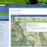
1. The Conservation Registry (Beta): This great online resource is a place for groups to share information about current conservation projects across the country – non-profits, state and federal agencies alike. You can search for projects nearby using the Map tools, search for projects in need of volunteer assistance, and just generally get a sense of what is going on in your back yard and beyond. Keep in mind that this is a ‘beta’ release meaning that the web site is just getting off the ground in our region but keep checking back as the registry grows. You will notice that ESLT has our projects on the map. Try This: Go to the URL below, Click ‘View Projects’ , ‘Browse by Maps’, and click down to the Eastern Sierra. Find a project and click ‘View detail page’ and learn more about what we have been up to. You can look at our project locations on aerial photos, topographic maps, and even see how they fall in relation to our Eastern Sierra public lands.
http://www.conservationregistry.org/
-
Conservation Registry
2. CalPhoto: In the most basic sense this site is a searchable inventory of photographs of plants, animals, and landscapes hosted by UC Berkeley. UC Berkeley is also where the Jepson Herbaria is located…and the two groups got together and created a really really useful resource. Not only can you find amazing photographs of plants, but you can also use the ‘Jepson Online Interchange’ to view a step-by-step Jepson Manual treatment, county distributions, and even specimen records and collection location maps. Use the URL below to search for your plant, click the [detail] link when you find what you are looking for. Pretty cool!
http://calphotos.berkeley.edu/
3. Calflora: What Grows Here: This website is a way to check out what plants grow in any region of your choice in California. Unlike CalPhoto you do not have to have a plant in mind. Use the simple search categories to zoom into a region (county, watershed, etc) click the ‘Search for Plants’ button and you will get a list (with pictures) of all the records for that region.
http://www.calflora.org/app/wgh?page=entry
4. California eBird: So as to not be too ‘plant-centric’ I wanted to share this tool with all you birders out there. This great site is a place for birders to share their observations with a much larger community of birders. In fact, some scientists are using this data for research as part of the Avian Knowledge Network. Though there are many cool aspects to this site, I find the ‘View and Explore Data’ options the neatest. From here you can visualize reported bird occurrences on maps, in charts, and in summary tables. The more sightings birders add, the more information there is to check out.
5. Repeat Photography & the Sierra Nevada Mountains: Okay so while this site may not have any direct applications for the inquiring cyber-natural-historian it still is REALLY cool. This fellow tracked down photographs of Yosemite in the early 1900s and then revisited and photographed those sites now. If you have spent time in Tuolumne you may recognize some of these landscapes. One of the ways that we inventory and track changes on our conservation projects is using photo point monitoring — this is a great example of how useful this method can be for illustrating change over time.
http://www.ridgelinephotography.com/Yosemite.htm
Are there any other great resources that you know about on the web? Share them with us and the ESLT community by commenting on this blog.
Enjoy!!
Aaron


Hi Aaron. In case you and your readers aren’t aware of it, I wanted to mention LandScope America (www.landscope.org) as another online conservation resource, which was beta-launched last December. The site is built to inform and inspire land conservation across the country through integrated maps, multimedia, and writing. Land Trusts and their constituents are a primary audience, along with governments and private landowners.
National Geographic and NatureServe teamed up to create the site, in partnership with Land Trust Alliance and many other organizations. One of the most important uses is to allow land trusts to easily create maps showing conservation priorities, wildlife and ecosystems, and pressures on the landscape. It has compiled hundreds of valuable GIS datasets from across the country and combined them with informative articles, photography, and videos in a user-friendly interface. We hope you and your members find it useful. We are seeking feedback on the site as we move from beta version to 1.0. We are also working to build out state “subsites” and Califronia is high on our list. We currently have built out WA, CO, FL, VA, & ME.
Keep up the great work guys!
Frank Biasi
National Geographic Society
[…] Northwest and is presently expanding to California. Since ESLT was one of the early adopters (see previous blog) of the resource, they asked if we would be willing to write about how we use the Conservation […]